Sign Up
School Account Sign Up
Lesson ID: 10840
Discover Mexico’s mountains, deserts, and beaches while learning how its land shapes life, culture, and history.


¡Bienvenidos a México! A Land of Contrasts
Imagine standing on a beach with turquoise waves behind you, snow-capped volcanoes on the horizon, and a desert stretching far to the north.

Welcome to Mexico—a land that packs nearly every kind of landscape into one dazzling country.
Its geography has shaped everything from ancient civilizations to modern cities and continues to influence daily life today.
Where in the World Is Mexico?
Mexico sits at the southern tip of North America, connecting it to Central America.
To the north, it shares a 2,000-mile border with the United States. To the south, it touches Belize and Guatemala.
The Pacific Ocean lies to the west, while the Gulf of Mexico and the Caribbean Sea shimmer to the east.
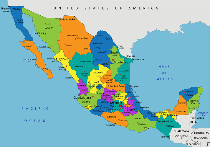
This strategic location makes Mexico a crossroads of cultures, trade, and nature. The Tropic of Cancer cuts right across the country, dividing its climates from hot and humid in the south to dry and desert-like in the north.
Mountains, Plateaus, and Peninsulas—Oh My!
Mexico’s terrain is as dramatic as its history.
Two giant mountain ranges—the Sierra Madre Occidental in the west and the Sierra Madre Oriental in the east—run like twin spines along the country’s coasts. A third, the Sierra Madre del Sur, curves across the south.
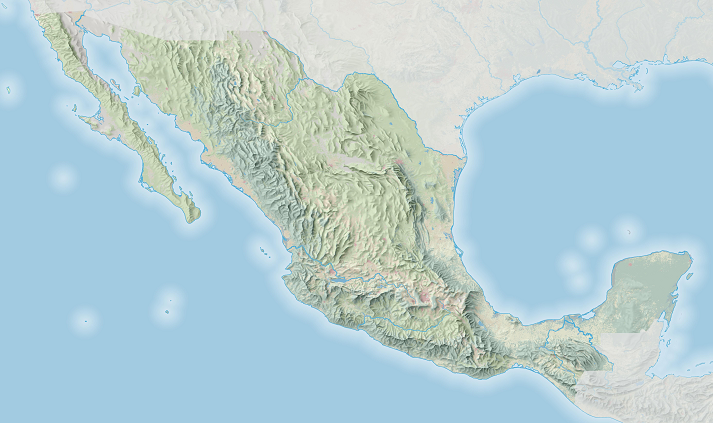
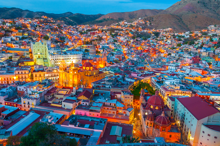
Between these ranges lies the Central Plateau, home to Mexico’s heart—Mexico City, one of the largest cities in the world. This plateau rises about 6,000 feet above sea level and covers nearly 40% of the nation’s land.
Its high elevation gives it mild temperatures, even when the deserts below are scorching hot.
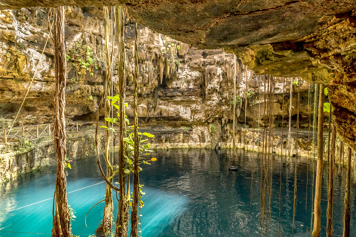
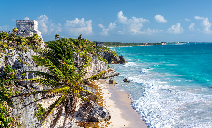
To the west juts the rugged Baja California Peninsula, where deserts meet the Pacific. To the east lies the Yucatán Peninsula, a flat region of limestone where rainwater disappears underground into mysterious sinkholes called cenotes.
These cenotes once provided the ancient Maya with fresh water and remain a striking feature of the landscape today.
Fiery Peaks and Deep Canyons
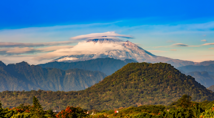
Mexico lies on the Ring of Fire, the world’s most active earthquake and volcano zone. Its tallest mountain, Pico de Orizaba, is actually a volcano that towers 18,491 feet high—taller than any peak in the continental United States.
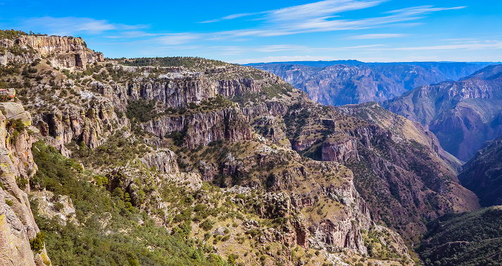
In the north, Mexico boasts Copper Canyon, a system of six canyons deeper and wider than the Grand Canyon. Carved by rivers over millions of years, its cliffs glow red and gold at sunset, earning it the name Barranca del Cobre—“Canyon of Copper.”
From Deserts to Jungles
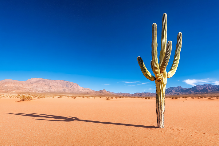
Head north, and you’ll find endless stretches of desert—like the Sonoran Desert, filled with towering cacti, and the Chihuahuan Desert, one of the largest in North America.
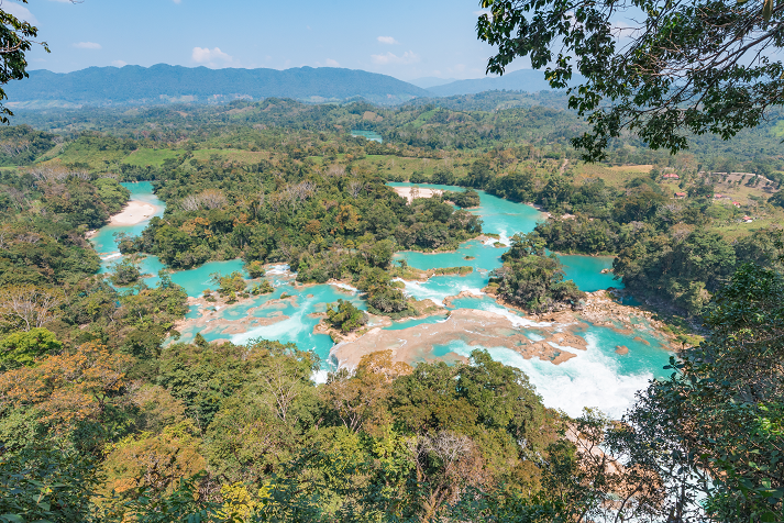
Travel south, and the scenery shifts dramatically to thick rainforests and tropical coastlines.
In the state of Chiapas, the Lacandon Jungle hums with the sounds of howler monkeys and tropical birds. Along the coasts, mangrove forests protect sea life and act as natural barriers during storms.
Mexico’s varied ecosystems make it one of the most biodiverse countries on Earth, home to jaguars, iguanas, whales, and over 700 species of reptiles.
Rivers, Lakes, and Coasts
Mexico’s rivers tell stories of both life and boundaries.
The Río Grande (Río Bravo del Norte) marks much of the border with the United States, while southern rivers like the Usumacinta and Grijalva wind through lush jungles toward the Caribbean.
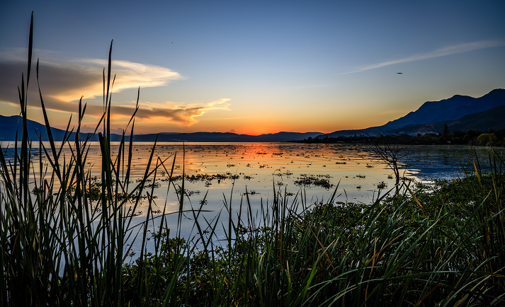
The largest lake, Lake Chapala, near Guadalajara, provides water and fish for nearby communities. Surrounding it are fertile valleys where crops like corn, avocados, and agave thrive.
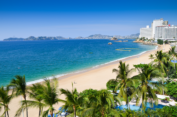
With coastlines on two major oceans, Mexico also boasts a vast fishing industry and renowned beach destinations, including Cancún, Acapulco, and Puerto Vallarta.
Geography Shapes Life
Mexico’s geography doesn’t just define its beauty—it shapes how people live.
Mountain valleys protect cities from wind and create microclimates perfect for farming. Coastal areas invite tourism and trade. In the north, the dry climate challenges farmers, while in the south, tropical rains can wash away entire roads.
Even the fight against illegal trafficking follows mountain routes and border rivers—geography influencing politics as much as agriculture.
A Country of Connections
From its deserts to rainforests, mountains to beaches, Mexico’s land connects people, cultures, and continents. Every region tells a different story—one of survival, creativity, and balance with nature.
Now that you’ve explored Mexico’s natural features and how they shape life, you’re ready to test what you know.
In the Got It? section, you’ll practice identifying Mexico’s regions, landforms, and landmarks!

Supplies
Additional Resources


